Dam data table
|
Dam No.:907
|
Shingu Dam [Ishikawa Pref.]
|
|
|
Dam Photo

(Photo by: Atsushi Kato)
|
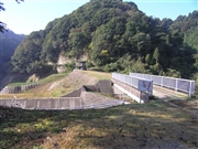 044842 Atsushi Kato
|
|
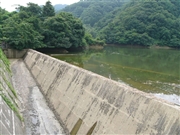 051350 Dam master
|
|
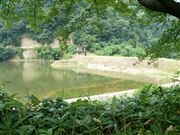 051362 Dam master
|
|
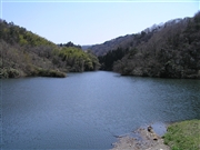 044837 Atsushi Kato
|
|
|
| Location (Latitude, Longitude) |
N 36°501' 12'',E 136°49' 11''
[Japanese Dam Finder]
|
| Purpose/Dam type |
A/E
|
| Height/Crest length/Dam volume |
25.4m/82.2m/35 thousand m3 |
| Catchment area/Water surface area |
6km2/6ha |
| Reservoir capacity |
424 thousand m3 |
| FY project started/completed |
/1955
|
