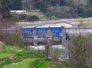
[Back]  [Dams in Japan]  [Japanese Page]


Dam data table
 
Dam No.:1016
 
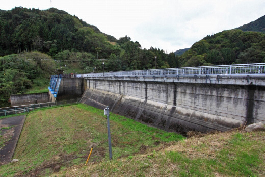
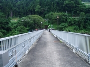
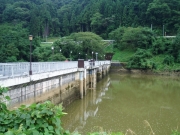
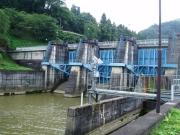
Yunose Dam [Nagano Pref.]


Dam Photo

(Photo by: Takashi Yasukochi)
192039 sagoH
192040 sagoH
192043 sagoH
028348 Hi Ace
Location (Latitude, Longitude) N 36°391' 50'',E 138°8' 00''   [Japanese Dam Finder]
Purpose/Dam type WP/G
Height/Crest length/Dam volume 18m/140m/15 thousand m3
Catchment area/Water surface area 256.5km2/7ha
Reservoir capacity 330 thousand m3
FY project started/completed 1965/1969


Notes:
1. Dam purposes are abbreviated as follows:
A: Agricultural irrigation   F: Flood control   I: Water supply for industry   N: Non-specified, river flow maintenance
P: Hydropower   R: Recreation   S: Snow melting &removing   W: Water supply

2. Dam types are abbreviated as follows:
A: Arch   B: Buttress   CSG: Trapezoidal CSG   E: Earthfill   FA: Asphalt face fill   FC: Asphalt core fill   G: Gravity
GF: Gravity concrete & fill dam (compound)   HG: Hollow gravity   MA: Multi-arch   R: Rockfill

3. The fiscal year (FY) in Japan is from April 1 to March 31 of the following year.

Please send your comments
Copyright 2012 JAPAN DAM FOUNDATION. All rights reserved.

[Back]  [Dams in Japan]  [Japanese Page]