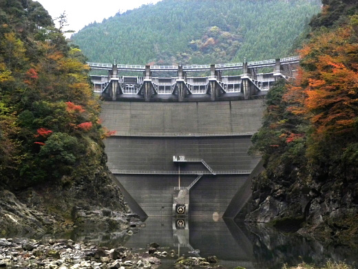
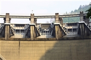
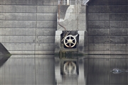
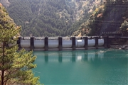
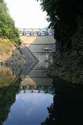
[Back]  [Dams in Japan]  [Japanese Page]


Dam data table
 
Dam No.:2129
 
Kominono Dam [Tokushima Pref.]

 → Kominono Dam(Re)
Dam Photo

(Photo by: 3A)
112149 Takashi Yasukochi
112154 Takashi Yasukochi
112157 Takashi Yasukochi
112129 Takashi Yasukochi
Location (Latitude, Longitude) N 33°481' 22'',E 134°14' 42''   [Japanese Dam Finder]
Purpose/Dam type P/A
Height/Crest length/Dam volume 62.5m/151.8m/40 thousand m3
Catchment area/Water surface area 270.8km2/89ha
Reservoir capacity 16750 thousand m3
FY project started/completed 1965/1968


Notes:
1. Dam purposes are abbreviated as follows:
A: Agricultural irrigation   F: Flood control   I: Water supply for industry   N: Non-specified, river flow maintenance
P: Hydropower   R: Recreation   S: Snow melting &removing   W: Water supply

2. Dam types are abbreviated as follows:
A: Arch   B: Buttress   CSG: Trapezoidal CSG   E: Earthfill   FA: Asphalt face fill   FC: Asphalt core fill   G: Gravity
GF: Gravity concrete & fill dam (compound)   HG: Hollow gravity   MA: Multi-arch   R: Rockfill

3. The fiscal year (FY) in Japan is from April 1 to March 31 of the following year.

Please send your comments
Copyright 2012 JAPAN DAM FOUNDATION. All rights reserved.

[Back]  [Dams in Japan]  [Japanese Page]