Dam data table
|
Dam No.:2261
|
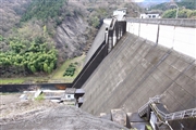
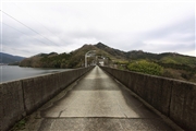
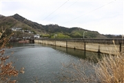
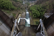
Tamagawa Dam [Ehime Pref.]
|
|
|
Dam Photo

(Photo by: Rui Abe)
|
 123440 Takashi Yasukochi
|
|
 123444 Takashi Yasukochi
|
|
 123446 Takashi Yasukochi
|
|
 123443 Takashi Yasukochi
|
|
|
| Location (Latitude, Longitude) |
N 33°591' 36'',E 132°55' 58''
[Japanese Dam Finder]
|
| Purpose/Dam type |
FNWI/G
|
| Height/Crest length/Dam volume |
56m/260m/187 thousand m3 |
| Catchment area/Water surface area |
38.1km2/64ha |
| Reservoir capacity |
9900 thousand m3 |
| FY project started/completed |
1964/1970
|
