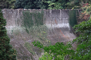
Dam data table
@
|
Dam No.F2592
@
|
Korobiishi Dam mNagasaki Pref.n
|
|
|
Dam Photo

iPhoto by: Takashi Yasukochij
|
|
| Location (Latitude, Longitude) |
N 33121' 08''CE 12945' 51''
[Japanese Dam Finder]
|
| Purpose^Dam type |
AW^G
|
| Height^Crest length^Dam volume |
22.7m^164m^ thousand m3 |
| Catchment area^Water surface area |
km2^3ha |
| Reservoir capacity |
246 thousand m3 |
| FY project started^completed |
1923^1927
|

