Dam data table
|
Dam No.:3232
|
Komachi Dam [Fukushima Pref.]
|
|
|
Dam Photo
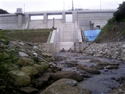 040270
|
|
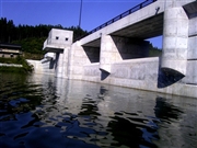 040271
|
|
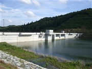 046657 Dai
|
|
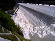 040272
|
|
|
| Location (Latitude, Longitude) |
N 37°161' 47'',E 140°35' 09''
[Japanese Dam Finder]
|
| Purpose/Dam type |
FNW/G
|
| Height/Crest length/Dam volume |
37m/150m/34 thousand m3 |
| Catchment area/Water surface area |
4km2/17ha |
| Reservoir capacity |
772 thousand m3 |
| FY project started/completed |
1994/2006
|

