[Back]  [Dams in Japan]  [Japanese Page]


Dam data table
 
Dam No.:3246
 
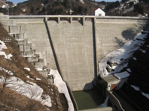
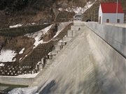
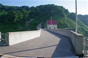
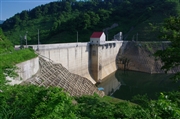
Tochigahara Dam [Niigata Pref.]


Dam Photo

(Photo by: s_wind)
121627 s_wind
124253 Dai
124252 Dai
121626 s_wind
Location (Latitude, Longitude) N 37°101' 56'',E 138°38' 03''   [Japanese Dam Finder]
Purpose/Dam type A/G
Height/Crest length/Dam volume 52.7m/152.5m/127 thousand m3
Catchment area/Water surface area 2.3km2/16ha
Reservoir capacity 2470 thousand m3
FY project started/completed 1993/2009


Notes:
1. Dam purposes are abbreviated as follows:
A: Agricultural irrigation   F: Flood control   I: Water supply for industry   N: Non-specified, river flow maintenance
P: Hydropower   R: Recreation   S: Snow melting &removing   W: Water supply

2. Dam types are abbreviated as follows:
A: Arch   B: Buttress   CSG: Trapezoidal CSG   E: Earthfill   FA: Asphalt face fill   FC: Asphalt core fill   G: Gravity
GF: Gravity concrete & fill dam (compound)   HG: Hollow gravity   MA: Multi-arch   R: Rockfill

3. The fiscal year (FY) in Japan is from April 1 to March 31 of the following year.

Please send your comments
Copyright 2012 JAPAN DAM FOUNDATION. All rights reserved.

[Back]  [Dams in Japan]  [Japanese Page]